I spent a day wandering around sunny Berwick, lovely little town, great friendly people and a selection of wonderful bridges. One thing I didnt like too much was the amount of traffic in the city centre all day. It felt dangerous crossing main roads.
Another great thing was the Town Walls and Ramparts said to be the finest in Europe and I find that hard to disagree with. Here is a seperate page for photos of the Town walls as there would be too many photos on this page. Berwick Town Walls.
16th August 2016


Royal Border Bridge.
Royal Border Bridge is a Grade I listed railway viaduct built between 1847 and 1850, when it was opened by Queen Victoria. The engineer who designed it was Robert Stephenson (son of George Stephenson). It was built for the York, Newcastle and Berwick Railway and is still in regular use today, as part of the East Coast Main Line.


Royal Tweed Bridge.
The Royal Tweed Bridge is a road bridge crossing the River Tweed. It was intended to divert traffic from the 17th century Berwick Bridge, and until the 1980s it formed part of the A1 road, the main route from London to Edinburgh. However, the construction of the A1 River Tweed Bridge to the west of Berwick has since reduced the Royal Tweed Bridge's importance.


Berwick (Old) Bridge.
Berwick Bridge, over the River Tweed at Berwick, was built between 1611 and 1634 by James Burrell. The red sandstone bridge has 15 arches and is 355 metres long. The bridge was almost complete in 1621, but severe flooding caused damage which put back its completion by several years. Five previous bridges stood on the site - The King (James I of England and James VI of Scotland) ordered the construction of the present bridge. It replaced a wooden bridge built in the reign of Henry VII (after 1485), which carried the main road from London to Edinburgh, but had become dilapidated.
Grade I listed. Source: Co-Curate.


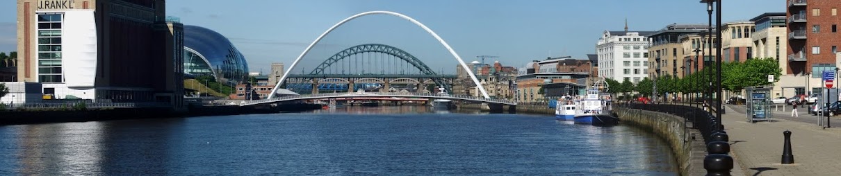
General views of the bridges.

Wallace Green Council Office.

Berwick Station.
Berwick-upon-Tweed railway station is on the East Coast Main Line in the United Kingdom, serving the town of Berwick-upon-Tweed, Northumberland. It is down the line from and is situated between to the south and to the north. It is the most northerly railway station in England, being less than three miles from the border with Scotland. The station, with its long single island platform, lies immediately to the north of the Royal Border Bridge.
In 1847, the Great Hall of Berwick Castle had to be demolished to make way for the new station (the former West Wall of the castle still marks the boundary of the now-defunct station goods yard), which opened the following year. This replaced an initial structure erected by the North British Railway, whose line from the north first reached the town in 1846. The Newcastle and Berwick Railway meanwhile reached the southern bank of the River Tweed in March 1847, but it was another eighteen months before a temporary viaduct across the river was commissioned to allow through running between Edinburgh and Newcastle. This in turn was replaced by the current Royal Border Bridge in July 1850. The station was rebuilt by the London and North Eastern Railway in 1927 and the buildings are Grade-II listed.
The station was also at one time served by local stopping trains between Newcastle and Edinburgh and the branch line from Newtown St Boswells via Kelso (which joined the main line at Tweedmouth, on the other side of the river) from 1851 until closure in 1964. For approximately 5 months in 1979, this was the terminus for services from London King's Cross after the East Coast Main Line was blocked by the collapse of Penmanshiel Tunnel. Buses linked this station with Dunbar, from where a railway shuttle service continued to Edinburgh Waverley.
Source: Co-Curate.


Town Hall.
1754-1760. Architects S and J Worrell who supplied plans, 2 elevations and 1 section for a fee of £31.10.0. Pattison and Dodds carried out the work.
Forms fine focal point for the East end of Marygate, standing commandingly in the middle of the roadway facing West along the main shopping street. West end has impressive giant Tuscan portico up a high flight of steps (4 columns), and frieze stating that the building was finished in 1754, restored 1857-8.
Entrance doorway under the portico is inscribed "Joseph Dods. archt." Surmounted by belfry 150 feet high, similar to Gibbs' St Martin in the Fields. East end facing Church Street/ Hide Hill corner has round arches on Tuscan columns, open and with paved butter market underneath on ground floor. South facade has 4 open arches and 10 arches now closed and occupied by shops. 1st floor contains good Georgian assembly room, with Venetian windows. Top floor has barred windows and housed the town gaol, now used as museum of gaol relics.
Source: Historic England.

Riverside Walk.


The Pier and Lighthouse.
This early C19 pier by John Rennie and lighthouse by Joseph Nelson are designated at Grade II for the following principal reasons: * Designers: John Rennie is considered to be one of the two greatest civil engineers of the day and Joseph Nelson was a prolific designer for Trinity House; both have a number of listed examples to their name. * Engineering: with a length of 880m, this pier is an impressive feat of early C19 engineering.
Source: Historic England.


Pier Road.


Castle Vale Park.


Hide Hill.


Holy Trinity Church.
Grade I listed Church of exceptional interest because of its rare date. Built 1648-52 by a London mason, with details comparable with St Katherine Cree. No tower. Chancel added in 1855, also clerestory windows. Arcade of 5 bays with round arches on round Tuscan columns. Jacobean West gallery and pulpit. Reredos is an early work by Lutyens.
Source: Historic England.


Church Street Police Station.


Church Street.


Queen Victoria Fountain, Castlegate.
The Jubilee Fountain is located next to the Scotsgate arch. Part of the inscription reads: 'To commemorate the sixtieth anniversary of Queen Victoria's accession to the thrown. Presented June 20 1887'.
Source: Geograph.

The Free Trade, Castlegate.

The Red Lion, Castlegate.

Scotsgate, Castlegate.
Scotsgate is part of the defensive Town Walls in Berwick-upon-Tweed. It dates from Elizabethan times, altered in 1815 and again in 1858. Scotsgate, between the streets of Marygate and Castlegate, has 3 arches, the central one now open for vehicles and the two at either side for pedestrian access.
Grade 1 listed structure and Scheduled Ancient Monument. Source: Co-Curate.


Castlegate.


Castle Ruins.
The castle's location in the hotly disputed border country between England and Scotland made it one of the most important strongholds in the British Isles, and it enjoyed an eventful history. As a major tactical objective in the region, the castle was captured by both the English and Scots on a number of occasions and frequently sustained substantial damage.


The Beach.

Berwick Barracks.

Bank Hill, Statue of Lady Jeringham.
Annie, Lady Jerningham (1850-1902) was married to first Charles Mather of Longridge Towers, Berwick and then to Hubert Jerningham, a British diplomat and Member of Parliament for Berwick (1881-1885). The latter became Governor of Mauritius, then Trinidad and Tobago, and was knighted for services in a cyclone in Trinidad and Tobago.
Lady Jerningham died on 9 October 1902, and her death was marked locally by the closing of shops and the lowering of blinds. Sir Hubert designed the monument in commemoration of his late wife with drawings by sculptor Walter Ingram. The latter of London and Brussels, had 38 exhibits at the Royal Academy between 1862 and 1894 (portrait busts). He died before completion, and the statue was sculpted by O P Pennacchini in Ealing, London, who exhibited once at the Royal Academy.
It was erected in Berwick in 1908 on a spot where at certain times of the year it could be seen from the subject's and Sir Hubert's home at Longridge Towers. At its unveiling the Mayor of Berwick spoke of Lady Jerningham's philanthropy: 'Generous and kindly she ever was'.
Grade 2 listed. Source: Historic England.

Bank Hill, The Leaping Salmon Inn
1798. Built as an elementary school from which boys passed to the Grammar School for a higher education. Now used as a public house. Stucco with stone cornice and quoins, scroll kneelers. Front to Bank Hill has inscribed datestone, and four 24-paned sash windows on each of two floors. Rear wing in L plan has five sash windows on each floor, facing Presbyterian Church. Gable end facing Golden Square has two sash windows on each floor and an additional small sash over a boarded door.
Grade 2 Listed. Source: Historic England.

Bank Hill.
More Information:
- Wikipedia - Berwick
- Wikipedia - Royal Border Bridge
- Wikipedia - Berwick Bridge
- Wikipedia - Berwick Castle
- Wikipedia - Church of the Holy Trinity, Berwick-on-Tweed
- Wikipedia - Berwick Barracks
- Wikipedia - Berwick Town Hall
- Wikipedia - Berwick Town Walls
- Historic England - Royal Border Bridge
- Historic England - Berwick Bridge
- Historic England - Berwick Castle
- Historic England - Church of the Holy Trinity, Berwick-on-Tweed
- Historic England - Berwick Barracks
- Historic England - East Barrack, Berwick Barracks Museum
- Historic England - Gateway and Gaurd House, Berwick Barracks Museum
- Historic England - Clock House Building, Berwick Barracks Museum
- Historic England - West Barrack and attached Perimeter Wall, Berwick Barracks Museum
- Historic England - Berwick Town Hall
- Historic England - Stocks, by The Town Hall
- Historic England - The medieval and post-medieval fortifications at Berwick upon Tweed
- Keys To The Past - Berwick
- Northumberland Communities - Berwick
- Co-Curate - Berwick
- Co-Curate - Historic Buildings and Monuments in Berwick
- Berwick-upon-Tweed Town Council
- Berwick Shipyard - Shipbuilding on the Tweed
- BBC - The British town with a third 'nationality'
- Friends of Berwick and District Museum and Archives
See my other photos around Berwick:
No comments:
Post a Comment